- Have any questions?
- +34 951 273 575
- info@allaboutandalucia.com
Discovering Ronda’s ‘hidden valley’

Mijas: A village that has kept its charm
July 14, 2016
At home in Ronda – the City of Dreams
July 14, 2016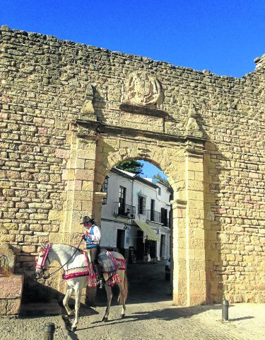
 Walking guru Guy Hunter-Watts describes a favourite walk close to his home and heart near Ronda
The Walk of the Hidden Valley: Montejaque Circuit
THIS spectacularly beautiful full day walk leads you to the heart of a wildly beautiful swathe of the Grazalema Park.
Departing from the charming white village of Montejaque, just 20 minutes from Ronda, you first face the most challenging part of the walk, an hour of climbing via a broad track to the top of the rocky Libar valley.
Here the terrain changes in nature as you cross a broad, flat-bottomed valley before cutting down through some of the most beautiful limestone formations in the park.
These huge, weathered blocks of karst have a sculptural beauty that is the rival of Henry Moore’s most monumental creations.
You continue on through two more flat-bottomed valleys, known locally as navas, through stands of ancient oak forest before descending back towards the village. Allow a full day to get the most out of this stunning itinerary.
The Nitty Gritty
Distance: 16.5kms
Time Required: 6/6.5 hours
Rating: Medium/Difficult
Map: IGN 1:50000 Ubrique (1050/14-44)
Water: none along the way so take at least 1,5 litres in your pack
The Walk
The walk begins in the main square in Montejaque. Cross the square, head along the left side of the church under a row of palms then go right into Calle Nueva. After 20m cut left into Calle Santa Cruz. Follow this street up through the village. Leaving the last houses behind you pass several ramshackle kennels built among the rocks. The road meets with a track by a G.R. marker post (15 mins).
Follow this track straight up the valley between the Sierra de Juan Diego and the Sierra de Benaojan. Nearing the top of the pass you cross a cattle grid. Continue for 300m then cut right, off the track, and go through a green gate in a stone wall (55 mins).
Bear left up a narrow cobbled path. Pass right of a stone ruin then an old corral. You come to a wall and a black gate which is often left open. The path, marked by cairns, leads beneath a clump of low oaks then crosses open ground before merging with a track. Bear right along the track. When you reach a rectangular sign on an oak cut left on a stony footpath. After about 60m the path arcs left. Look for cairns which guide you through a stand of low oaks. After angling back to the right the path leads down to a stone wall. Passing through the gap the path merges with a track which you follow across a vast, walled field. Having passed two bulldozed watering holes the track reaches a gap in a stone wall. Bear right just before the opening and, just beyond a large oak, go through a metal gate (1 hr 25 mins).
Bear left on a narrow path, following the right side of the stone wall. The path climbs, bears left then reaches a flat area. Here bear sharp right on a narrow path which threads between the rocks and descends. After dropping down for about 15 minutes you pass left of a ruined stone hut then go through a gate whose opening is sometimes closed with brush. Following cairns, and making sure not to climb at any point, you reach a second vast field, similar in size to the one you traversed earlier. It’s the eponymous Hidden Valley of my title (1 hr 55 mins).
Careful! Look for a large stone arrow on the ground at the field’s edge. This indicates your course across the field: you need to angle about 45º right in a NNW direction. Crossing the field you pass a group of three huge oaks whose trunks meet at the base. On the far side a wall drops down to meet with the field by another stone arrow, beyond which you leave the field via an indistinct path which climbs up across the rocks. It soon becomes better defined: you’ll see a fence up to your left. Soon you reach a hollow with a stone-walled corral built against a cliff face (2 hrs 25 mins).
Keep left, contouring high above the hollow. The path leads over a ridge as the countryside opens out. At this point look for a small farm ahead of you: you’ll later be passing it by. The path descends, goes through a gate, then angles down across the hillside to a low stone wall and a fence. Follow the stone wall along to the left to reach a wire-and-post gate. Beyond the gate cross a (dry) stream. Continue straight ahead (there’s no path) for 125m. Crossing a low ridge you reach a track which you follow to the right, up towards the farm you could see earlier. Pass across the farm’s beautiful cobbled era (threshing circle) then angle left and pass left of the farm and its stone corrals to reach another track which leads to a metal gate in a stone wall (2 hrs 50 mins).
Pass through the gate and after just 10m bear left on the track passing a sign for ‘Montejaque’. You pass a chain which cuts the track then reach an open patch of ground. Bear right along its lower edge then enter a wooded area. The path is indistinct: look for cairns and don’t climb too high. The path twists through the forest, crosses a stream then climbs an eroded bank to another gate. Beyond the gate the path climbs, angles right then crosses a (dry) stream. The landscape again opens out and you reach a low stone wall. Ahead is another vast field. Bearing left, stick to the northern edge side of the field. Continue to its far end to reach its boundary wall where you go through a metal gate (3 hrs 20 mins).
Bearing slightly right, cross a (dry) stream then bear left again and cross back to the other side. Continuing up the middle of the enclosure you pass a metal drinking trough. Soon the path runs just to the left of a wall and leads to the far end of the field. Here, go through a metal gate. After just 10m the path merges with a track which you follow downwards. Soon you pass a monument, tucked in to the left of the track, which marks the spot where a landowner was shot during the Civil War. 250m past the monument the track bears right and climbs to the top of a rise, passing a cattle grid: brace yourself for the steepest part of the walk. Just beyond it go through a gap in a wall where your track merges with a second one (3 hrs 50 mins).
Here bear right and descend steeply. Soon the track loops hard right, then left. Still descending steeply be ready to cut right off the track on another track which angles steeply up to your right: look for cairns. (but see * below). Where this track loops hard right cut left at a cairn and follow an indistinct path down to a black metal gate (4 hrs).
Beyond the gate the path becomes clearer as it runs between olive groves, then becomes more overgrown. Twice you’re forced to cut right and continue parallel to the path through the olives. You rejoin the path and soon it loops across a (dry) stream. Beyond the stream (careful not to lose height) continue just right of a line of olives. Look for cairns! The line of the path, which has been ploughed into the grove in parts, is soon visible once again, running up to a brown metal sign which you pass to its right. The path improves then merges with a track. Continuing along this track you reach a wire-and-post gate (4 hrs 25 mins).
Go through the gate. The track arcs right, levels, then loops down into the valley that you circle) to the left of the track then come to a junction. Here cut right, then first left, then retrace your footsteps back to the square in Montejaque (4 hrs 55 mins).
Walking in Andalucia, Edition 7 by Guy Hunter-Watts is available at most good bookshops. It has 36 walks.

